Flood Stage information for Alhambra Creek at D Street
|
|
Flood Stage Estimate for Alhambra Creek @ D Street ACZ on Alhambra Creek, Martinez |
|
|
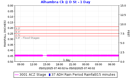
Flood stages have been determined for this stream gauge located south of the D Street crossing of Arroyo del Hambre (aka Alhambra Creek) in Martinez. Please report flooding location and time: Click to report Flooding from Alhambra Creek including time and location. The plot below shows the latest stage data with horizontal lines for the gauge stages at locations in the table below. |
||
|
|
||
FLOOD STAGESReadings at the gauge that could indicate flooding at the location. |
||
|
Flooding Order |
Gauge Stage |
Flooding Locations |
|
7th |
10.6 |
Flora Street |
|
6th |
10.1 |
Escobar Street to Marina Vista |
|
5th |
9.3 |
D Street | Down Alhambra Avenue and Casto Street | Ferry Street Bridge to Henrietta Street |
|
4th |
8.9 |
Near ped bridge 450 ft downstream of RR Tracks |
|
3rd |
8.4 |
Upstream side of Ferry Street |
|
2nd |
7.5 |
Down Stream of Marina Vista Avenue Bridge |
|
1st |
6.8 |
Inlet on Alhambra-Across from B Street |
How was the flood stage developed? |
Computer ModelA model of the creek was created using LiDAR to make a terrain surface to take creek cross sections from. This was augmented with surveying of specific cross sections and bridges. The HEC-RAS model was run using several estimated flow. Flows were estimated using USGS StreamStats. |
|
Certainty of flood stage accuracy? |
We have 80% confidence in the model results.LiDAR quality in the creek area is degraded by tree cover, making some terrain data unreliable. Additional surveying would improve accuracy, but funding was unavailable for that work. The survey data reflected differences in the channel bottom since the date the LiDAR was flown in approximately 2008. We did not survey every bridge. To be fully confident in the model we would need to survey the entire creek reach. LiDAR stands for Light Detection and Ranging. It's a technology that uses laser light to measure distances. |
|
Future Efforts |
The FC District can work with "&G1& may send postcards with information to properties owners along the creek. This could include information on how they can help fine-tune the flood stage by reporting where and when flooding is experienced. |
|
|
View Alhambra Creek @ D Street flood stages: ACZ Direct Plot Link. |
||
|
Click to report Flooding from Alhambra Creek including time and location. |
||
|
Click here for Flood Stage Report and Maps |
||

Date: 3/13/2026 12:21:53
File location: G:\fldctl\Hydrology\Streamflow\Flood Stage Information Web Docs\AA-Merge_HTML.docm