Flood Stage information for Grayson Creek at Taylor Boulevard
|
|
Flood Stage Estimate for Grayson Creek @ Taylor Boulevard GCC on Grayson Creek, Pleasant Hill |
|
|
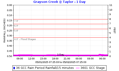
Flood stages have been determined for this stream gauge located on the footbridge over Galindo Creek just north of Treat Blvd in Pleasant Hill. Please report flooding location and time: Click to report Flooding from Grayson Creek including time and location. The plot below shows the latest stage data with horizontal lines for the gauge stages at locations in the table below. |
||
|
|
||
FLOOD STAGESReadings at the gauge that could indicate flooding at the location. |
||
|
Flooding Order |
Gauge Stage |
Flooding Locations |
|
8th |
7.9 |
800 Ruth Drive |
|
7th |
7.4 |
Oak Park Lane (Murderers Creek ) |
|
6th |
7.3 |
509 Masefield Drive (Murderers Creek ) |
|
5th |
6.9 |
Theo Lane Ft Bridge (Murderers Creek ) |
|
4th |
6.6 |
Boyd Road (Grayson Creek) | Boyd Road (Murderers Creek ) | Babette Court |
|
3rd |
6.1 |
265 Campbell Lane |
|
2nd |
5.8 |
245 Stevenson Drive (Murderers Creek ) |
|
1st |
4.0 |
110 Poshard Street (Murderers Creek ) |
How was the flood stage developed? |
Computer ModelExisting models were used for this gauge. Flows in model were used. |
|
Certainty of flood stage accuracy? |
We have 95% confidence in the model results.The model was developed by the Corps of Engineers and has possibly been modified by others. We updated a replaced bridge. |
|
Future Efforts |
The FC District may send postcard information to properties along the creek. This could include information on how they can help fine-tune the flood stage by reporting where and when flooding is experienced. |
|
|
View Grayson Creek @ Taylor Boulevard flood stages: GCC Direct Plot Link. |
||
|
Click to report Flooding from Grayson Creek including time and location. |
||
|
Click here for Flood Stage Report and Maps |
||

Date: 3/13/2026 12:22:06
File location: G:\fldctl\Hydrology\Streamflow\Flood Stage Information Web Docs\AA-Merge_HTML.docm