Flood Stage information for Tice Creek at Rossmoor Basin
|
|
Flood Stage Estimate for Tice Creek @ Rossmoor Basin RMB on Tice Creek, Walnut Creek |
|
|
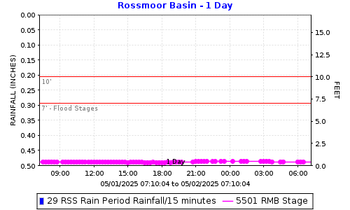
Flood stages have been determined for this stream gauge located at the detention basin located near the intersection of Tice Valley Blvd and Rossmoor Parkway, near the entrance to Rossmoor in Walnut Creek. Please report flooding location and time: Click to report Flooding from Tice Creek including time and location. The plot below shows the latest stage data with horizontal lines for the gauge stages at locations in the table below. |
||
|
|
||
FLOOD STAGESReadings at the gauge that could indicate flooding at the location. |
||
|
Flooding Order |
Gauge Stage |
Flooding Locations |
|
2nd |
10.0 |
Down stream of Castle Hill Road |
|
1st |
7.0 |
Meadow Lane Bridge |
How was the flood stage developed? |
Computer ModelA model of the creek was created using LiDAR to make a terrain surface to take creek cross sections from. This was augmented with surveying of specific cross sections and bridges. The HEC-RAS model was run using several estimated flow. The Basin had a curve relating water elevation and basin outflow. The flows in reaches downstream work estimated based on old studies. |
|
Certainty of flood stage accuracy? |
We have 75% confidence in the model results.LiDAR quality in the creek area is degraded by tree cover, making some terrain data unreliable. Additional surveying would improve accuracy, but funding was unavailable for that work. The available flow estimates come from an older study that proposed a bypass pipe to reduce flooding, running from the crossing west of Timber Bridge Rd down Tice Valley Blvd and Meadow Road. That study estimated a flow of 600 cfs in Tice Creek downstream of the crossing. Without the bypass, the creek will flood, and not all estimated flow will stay within the channel. While we can estimate creek flow, the extent of flooding remains uncertain. LiDAR stands for Light Detection and Ranging. It's a technology that uses laser light to measure distances. |
|
Future Efforts |
The FC District may send postcard information to properties along the creek. This could include information on how they can help fine-tune the flood stage by reporting where and when flooding is experienced. |
|
|
View Tice Creek @ Rossmoor Basin flood stages: RMB Direct Plot Link. |
||
|
Click to report Flooding from Tice Creek including time and location. |
||
|
Click here for Flood Stage Report and Maps |
||

Date: 3/13/2026 12:22:01
File location: G:\fldctl\Hydrology\Streamflow\Flood Stage Information Web Docs\AA-Merge_HTML.docm