Flood Stage information for Wildcat Creek at Vale Road
|
|
Flood Stage Estimate for Wildcat Creek @ Vale Road Bridge VBR on Wildcat Creek, San Pablo |
|
|
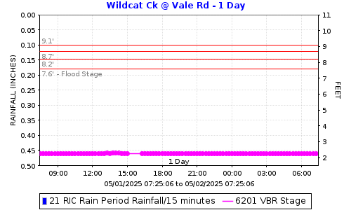
Flood stages have been determined for this stream gauge located upstream of Vale Road at San Pablo and Richmond city limits. Please report flooding location and time: Click to report Flooding from Wildcat Creek including time and location. The plot below shows the latest stage data with horizontal lines for the gauge stages at locations in the table below. |
||
|
|
||
FLOOD STAGESReadings at the gauge that could indicate flooding at the location. |
||
|
Flooding Order |
Gauge Stage |
Flooding Locations |
|
4th |
9.1 |
23rd Street | Pullman Street |
|
3rd |
8.7 |
Near Folsom Avenue and 15th Street | Mariela Court |
|
2nd |
8.2 |
Manor Drive | Standard Avenue/Van Ness Street |
|
1st |
7.6 |
North Side down stream of John Herbet Davis Park | University Avenue | Mason Street |
How was the flood stage developed? |
Computer ModelA HEC-RAS Model was made using LiDAR, survey data and some as-built plans. Flows were estimated using USGS StreamStats. |
|
Certainty of flood stage accuracy? |
We have 80% confidence in the model results.LiDAR quality in the creek area is degraded by tree cover, making some terrain data unreliable. Additional surveying would improve accuracy, but funding was unavailable for that work. The survey data reflected differences in the channel bottom since the date the LiDAR was flown in approximately 2008. We did not survey every bridge. To be fully confident in the model we would need to survey the entire creek reach. LiDAR stands for Light Detection and Ranging. It's a technology that uses laser light to measure distances. |
|
Future Efforts |
The FC District may send postcard information to properties along the creek. This could include information on how they can help fine-tune the flood stage by reporting where and when flooding is experienced. |
|
|
View Wildcat Creek @ Vale Road Bridge flood stages: VBR Direct Plot Link. |
||
|
Click to report Flooding from Wildcat Creek including time and location. |
||
|
Click here for Flood Stage Report and Maps |
||

Date: 3/13/2026 12:22:03
File location: G:\fldctl\Hydrology\Streamflow\Flood Stage Information Web Docs\AA-Merge_HTML.docm